The Aquatic Bio-optics and Biogeochemistry Laboratory enables researchers to study the effects of climate change and permafrost thawing on lake water transparency and mixing dynamics and their multiple impacts on the microbial food chain, greenhouse gas emissions, and oxythermal habitat. Research at the Aquatic Bio-Optics and Biogeochemistry Laboratory also focuses on developing optical equipment for early detection of algal and cyanobacterial blooms and other problems related to water browning.
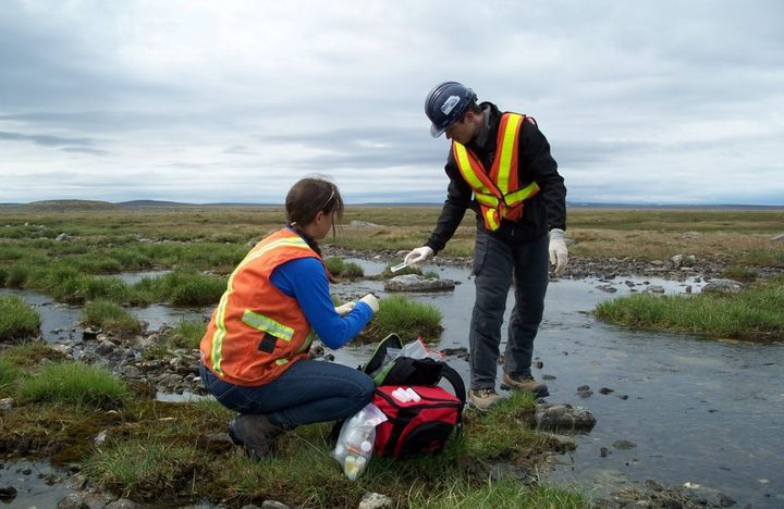
The station is located 10 km north of Sacré-Coeur, near the Ste-Marguerite River, a tributary of the Saguenay. The station is used for training in hydrometry, geomorphology, ecology and research in hydrology and fish habitats. The scientific equipment includes: a weather station, a water temperature monitoring station in the Ste-Marguerite River, an ADCP measuring the flow from May to November in the Ste-Marguerite River. Users also have access to mobile ADCPs (Sontek M9 and Teledyne Streampro), electric fishermen, thermographs and turbidimeters. The facilities include a laboratory area, a chalet with a classroom for 30 people, a dormitory for 35 people, a kitchen / cafeteria and a sanitary area with showers. She is in operation from May to November. The station belongs to the Interuniversity Center for Research on Atlantic Salmon (CIRSA) and is managed by the INRS.

Confocal microscopy and flow cytometry laboratoryThe laboratory is equipped with a four-laser LSRFortessa cytometer that allows high-level multiparametric analyzes to characterize cell populations. A BD FACS Calibur two-laser cytometer is used to perform routine analyzes such as the expression of surface markers. The Zeiss LSM780 confocal microscopy system is a state-of-the-art instrument for the study of various cellular and subcellular biological processes such as intracellular trafficking and localization of pathogen molecules.
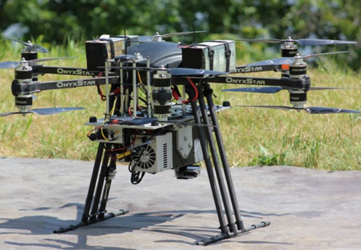
Processing and analysis of earth observation images in order to map and model environmental phenomena in the context of climate change. The research team in Environmental and NORdic Remote Sensing (TENOR) works on the development and application of digital approaches and the development of analysis and decision support tools applicable to various contexts by calling upon particularly in hydro-informatics, geomatics and remote sensing. The Environmental Remote Sensing by Drones (TED) laboratory includes different types of drones and a wide range of sensors: two hyperspectral cameras (400-1700 nm), a thermal infrared camera, a multispectral camera with interchangeable filters and a digital camera. The TENOR team also has a computer laboratory equipped with software specialized in image processing and geomatics, as well as field instrumentation (georadar, snow and ice corers, hydrometeorological sensors, etc.) necessary for the development and validation of algorithms.
This pilot laboratory provides the scientific community and industry with its multidisciplinary expertise and state-of-the-art equipment for the development and scaling of fermentation processes as well as the recovery, purification and characterization of various microbial derivatives. Its primary purpose is R & D in the field of biotechnology, and especially value-added products using putrescible residues as raw material.

This laboratory makes it possible to develop, among other things, sustainable approaches to coastal management to counter the erosion caused by climate change. This world-class laboratory is used to simulate swells, tides and high flow currents affecting the majority of coarse-bed streams, such as rivers and the St. Lawrence River. It offers a rich potential of applications, for example:
- Model the equilibrium profile of beaches for the stabilization of shorelines;
- Model sedimentation in harbors and marinas to plan dredging or control sediment drift;
- Study the interaction of currents and waves on coastal structures and at sea;
- Model overflow and overflow phenomena due to sea level rise on Canadian coasts;
- Simulate the effect of tides on port facilities;
- Simulate the effect of ice on banks in the presence of waves and currents;
- Model the diffusion of pollutants in complex hydraulic systems;
- Design arrangements or soft solutions for coastal protection.
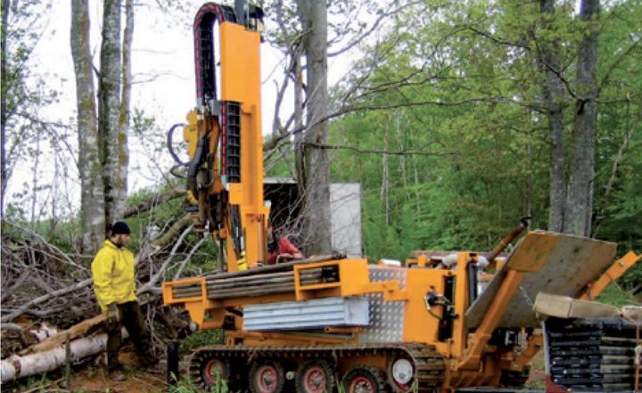
The main equipment for characterizing the physical and geochemical properties of aquifers is a specialized Geotech 605 drilling rig. With the data collected, it is possible to model the flow of water and the transport of contaminants in aquifers. It is also possible to assess the vulnerability of aquifers to contamination, to determine the most suitable protection methods and methods of exploitation for sustainable management of the groundwater resource. This crawler drill has a real-time recording system of mechanical and electrical soil responses. It also allows soil or groundwater sampling by installing observation wells. The system has two drilling heads, one for drilling by penetration (cone penetration) in loose deposits, and another equipped with a hydraulic hammer for rotary impact drilling up to 50 m in rock and loose deposits according to the conditions.

The research conducted at the Geothermal Open Laboratory is aimed at gaining better understanding of underground heat transfer and flow phenomena for reducing technical risks of geothermal energy. It is an open access laboratory, modeled after open-source software.
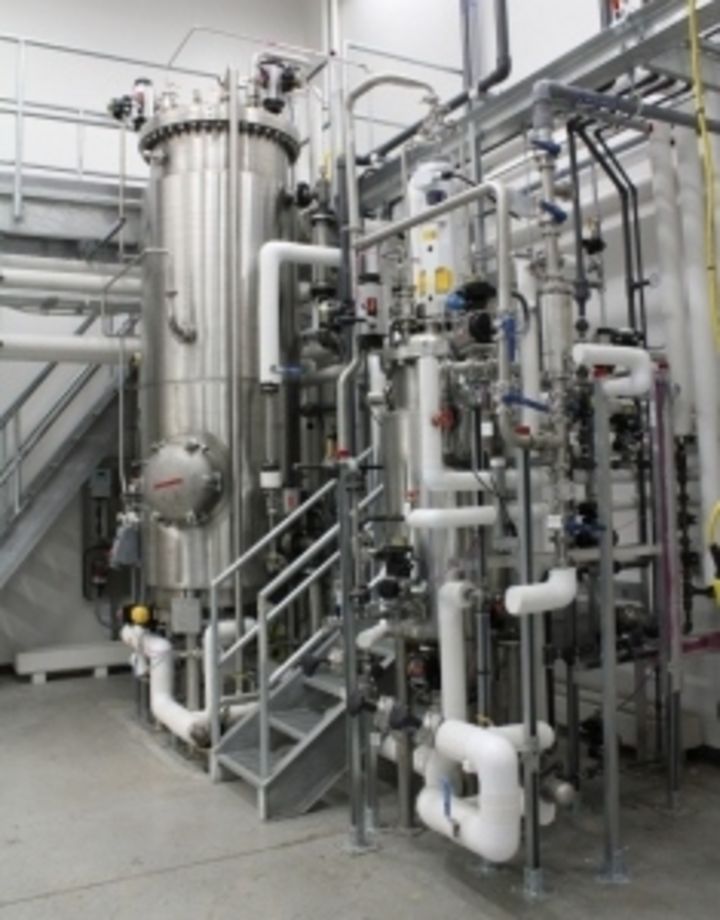
• Ionic Chromatograph
• Gas and liquid chromatographs
• Mass spectrometers
• Level 2 Laboratory for Bacteria

This laboratory is used in particular to carry out research work on understanding the environmental fate of energetic materials. The laboratory consists of two experimental pans, the size of which makes it possible to carry out restoration experiments similar to field conditions, but under controlled experimental conditions. These tanks can contain 4 to 9 m3 of soil from contaminated sites or clean soils to which specific contaminants can be added.