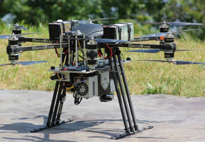
Processing and analysis of earth observation images in order to map and model environmental phenomena in the context of climate change. The research team in Environmental and NORdic Remote Sensing (TENOR) works on the development and application of digital approaches and the development of analysis and decision support tools applicable to various contexts by calling upon particularly in hydro-informatics, geomatics and remote sensing. The Environmental Remote Sensing by Drones (TED) laboratory includes different types of drones and a wide range of sensors: two hyperspectral cameras (400-1700 nm), a thermal infrared camera, a multispectral camera with interchangeable filters and a digital camera. The TENOR team also has a computer laboratory equipped with software specialized in image processing and geomatics, as well as field instrumentation (georadar, snow and ice corers, hydrometeorological sensors, etc.) necessary for the development and validation of algorithms.

This laboratory makes it possible to develop, among other things, sustainable approaches to coastal management to counter the erosion caused by climate change. This world-class laboratory is used to simulate swells, tides and high flow currents affecting the majority of coarse-bed streams, such as rivers and the St. Lawrence River. It offers a rich potential of applications, for example:
- Model the equilibrium profile of beaches for the stabilization of shorelines;
- Model sedimentation in harbors and marinas to plan dredging or control sediment drift;
- Study the interaction of currents and waves on coastal structures and at sea;
- Model overflow and overflow phenomena due to sea level rise on Canadian coasts;
- Simulate the effect of tides on port facilities;
- Simulate the effect of ice on banks in the presence of waves and currents;
- Model the diffusion of pollutants in complex hydraulic systems;
- Design arrangements or soft solutions for coastal protection.

The research conducted at the Geothermal Open Laboratory is aimed at gaining better understanding of underground heat transfer and flow phenomena for reducing technical risks of geothermal energy. It is an open access laboratory, modeled after open-source software.