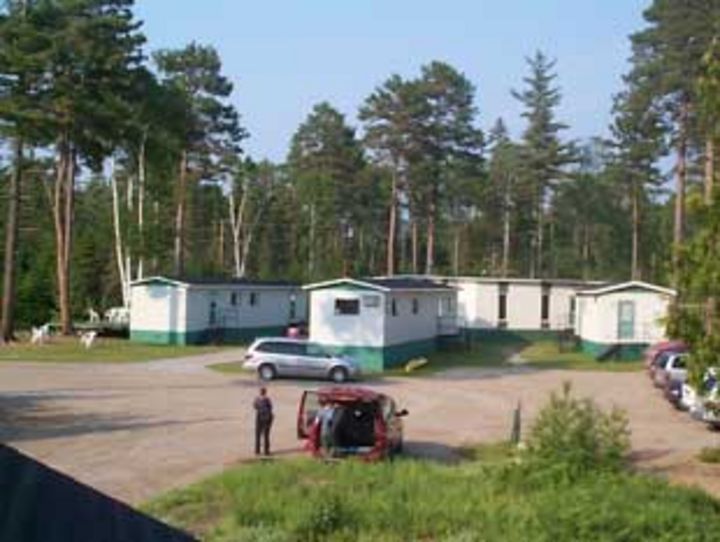
The station is located 10 km north of Sacré-Coeur, near the Ste-Marguerite River, a tributary of the Saguenay. The station is used for training in hydrometry, geomorphology, ecology and research in hydrology and fish habitats. The scientific equipment includes: a weather station, a water temperature monitoring station in the Ste-Marguerite River, an ADCP measuring the flow from May to November in the Ste-Marguerite River. Users also have access to mobile ADCPs (Sontek M9 and Teledyne Streampro), electric fishermen, thermographs and turbidimeters. The facilities include a laboratory area, a chalet with a classroom for 30 people, a dormitory for 35 people, a kitchen / cafeteria and a sanitary area with showers. She is in operation from May to November. The station belongs to the Interuniversity Center for Research on Atlantic Salmon (CIRSA) and is managed by the INRS.

The St. Marthe Experimental Watershed consists of a set of hydrometeorological measurement stations continuously recording the key parameters related to hydrology and snow. These measurement points are located in and near the drainage zone of tributary 29 of Rivière à la Racquette. It has an area of almost 10 km2.
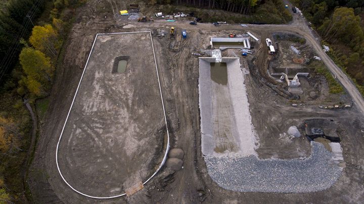
The hydrology, hydraulics and environment research complex is a unique research infrastructure in Canada. The research complex, located outside the main campus of the University of Sherbrooke, consists of an experimental watershed and an experimental river. Covering an area of approximately 0.4 ha, the watershed is 100 m long and varies in width from 30 m at its outlet to about 50 m at its widest point. The bottom and the walls are made up of an assembly of concrete walls and geomembranes to ensure complete watertightness of the basin. The depth of the basin varies between 3 m at its outlet to almost 5 m upstream. The basin is filled with mixed soil taken from the site and made up of till, sand and gravel with spatial heterogeneities. A groundwater collection system with drainage pipes and valves is used to control the water table. A set of instruments and sensors include rain gauges, soil moisture probes, piezometers, pressure monitors, lysimeters, a weather station and a snowpack analyzer which provides a detailed portrait of the state and flux variables in the watershed.
The experimental river is made up of a dynamic river channel 3 m wide and 50 m long with an initial slope of 0.5%. The canal can wind freely in a valley 20 m wide. The corridor is filled with a mobile substrate at least 1 m thick which allows to modify the shape, the slope, the roughness and the topography. An impermeable membrane is placed under the bed and the banks of the canal to minimize water loss by infiltration. The backfill material is composed of a mixture of gravel/rounded sand. The river operates as a closed circuit system. The water, which circulates in a loop, is conveyed by two variable speed centrifugal pumps totaling 0.8 m3/s to a supply channel and a head tank and will flow into the experimental river via a weir. The depth of flow at the downstream end of the river is controlled by a flow valve, after which the water flows into a sedimentation basin and then to the pumping basin. The transported sediments are collected in the sedimentation basin and will be transported/stored upstream via the sediment recirculation system.
The infrastructure will be accessible as a priority to researchers who obtained the grant that allowed the construction, some of which are members of CentrEau, as well as to collaborating researchers. Researchers who do not collaborate with the principal investigators will also be able to use the infrastructure. Charges may apply.