The Aquatic Bio-optics and Biogeochemistry Laboratory enables researchers to study the effects of climate change and permafrost thawing on lake water transparency and mixing dynamics and their multiple impacts on the microbial food chain, greenhouse gas emissions, and oxythermal habitat. Research at the Aquatic Bio-Optics and Biogeochemistry Laboratory also focuses on developing optical equipment for early detection of algal and cyanobacterial blooms and other problems related to water browning.
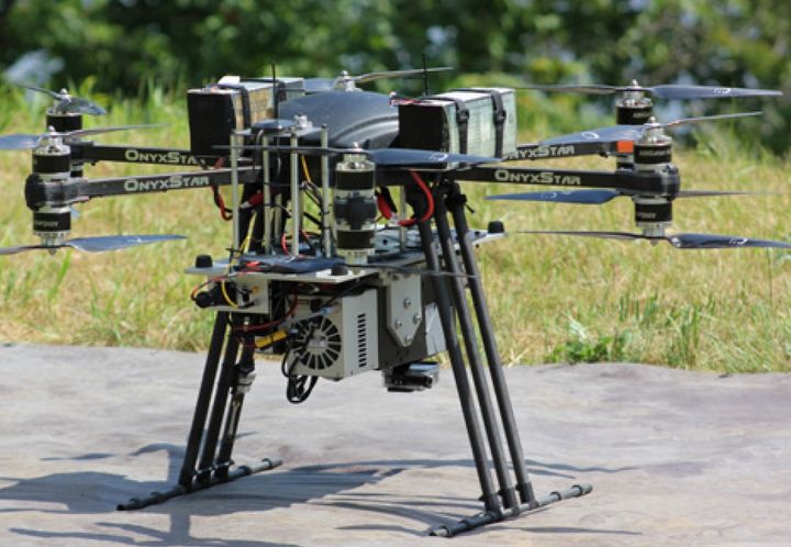
Processing and analysis of earth observation images in order to map and model environmental phenomena in the context of climate change. The research team in Environmental and NORdic Remote Sensing (TENOR) works on the development and application of digital approaches and the development of analysis and decision support tools applicable to various contexts by calling upon particularly in hydro-informatics, geomatics and remote sensing. The Environmental Remote Sensing by Drones (TED) laboratory includes different types of drones and a wide range of sensors: two hyperspectral cameras (400-1700 nm), a thermal infrared camera, a multispectral camera with interchangeable filters and a digital camera. The TENOR team also has a computer laboratory equipped with software specialized in image processing and geomatics, as well as field instrumentation (georadar, snow and ice corers, hydrometeorological sensors, etc.) necessary for the development and validation of algorithms.

This laboratory makes it possible to develop, among other things, sustainable approaches to coastal management to counter the erosion caused by climate change. This world-class laboratory is used to simulate swells, tides and high flow currents affecting the majority of coarse-bed streams, such as rivers and the St. Lawrence River. It offers a rich potential of applications, for example:
- Model the equilibrium profile of beaches for the stabilization of shorelines;
- Model sedimentation in harbors and marinas to plan dredging or control sediment drift;
- Study the interaction of currents and waves on coastal structures and at sea;
- Model overflow and overflow phenomena due to sea level rise on Canadian coasts;
- Simulate the effect of tides on port facilities;
- Simulate the effect of ice on banks in the presence of waves and currents;
- Model the diffusion of pollutants in complex hydraulic systems;
- Design arrangements or soft solutions for coastal protection.

The research conducted at the Geothermal Open Laboratory is aimed at gaining better understanding of underground heat transfer and flow phenomena for reducing technical risks of geothermal energy. It is an open access laboratory, modeled after open-source software.

The UdeS hydraulic laboratory is one of the largest in Canada. It is used as much for the courses as for the research or the realization of expertises. Numerous assemblies and several channels allow the visualization and the experimentation of almost all the phenomena of the hydraulics with free surface and under pressure. It includes a 40 hp pump, a charging system, a gauging station, channels, numerous valves and a wave channel. Measuring instruments using the latest technologies, such as acoustic doppler velocimetry, are connected to computerized data acquisition systems.
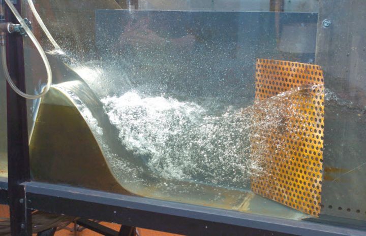
The hydraulics laboratory of the civil engineering department has several equipment to reproduce flows with free surface and load. It includes a 40 hp pump, a charging system, a gauging station, channels, numerous valves and a wave channel. Measuring instruments using the latest technologies, such as acoustic doppler velocimetry, are connected to computerized data acquisition systems. As part of research activities, specific editing can be done. Currently, we can observe a test bench to assess, in full size, the hydraulic capacity of the storm sewer grilles.
LIASHyC aims to be a world reference in the field of complex hydrogeological systems through the quality and relevance of its research and innovation, training and transfer activities. The research and innovation program focuses on fractured media hydrogeology, hydrogeology of northern and alpine regions, and characterization of hydrogeological heterogeneities. LIASHyC consists of the following parties:
- Institute of Earth Sciences of the UNIL (ISTE-UNIL)
- Center of Hydrogeology and Geothermal Energy of UNINE (CHYN-UNINE)
- Center Eau Terre Environnement of the INRS
- Department of Geology and Geological Engineering of Laval University

The Applied Geophysics Laboratory of the Department of Geology and Geological Engineering includes several geophysical equipment for the non-destructive auscultation of physical environments for Earth science needs. This equipment is supplemented by a linear thrust system with a capacity of 10000 kg to carry out penetration tests with electro-seismic piezocone with constant penetration rate. These tests provide precise but timely information on the stratigraphy of the environment studied. In order to extend this stratigraphy to the whole of a given study site, the geophysical methods of surface auscultation of the physical environments (profiles of georadar, 2D and 3D tomography of induced polarization, surveys of seismic refraction and reflection, ...) are then used.
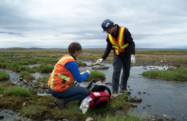
The hydrogeology laboratory has the necessary equipment to measure the basic hydraulic parameters in samples of loose materials, namely the saturated hydraulic conductivity, the porosity and the water retention curve of partially saturated soils. It is also possible to perform solute tracing tests in dissolved form to determine the transport parameters of a porous medium.

The microanalysis laboratory offers the scientific community, businesses and industry a characterization service for natural and synthetic materials. The laboratory operates a CAMECA SX-100 electronic microprobe and a JEOL 840-A scanning electron microscope (SEM). The laboratory also operates a Siemens D5000 X-ray diffractometer.